West Fork at Jones Creek Habitat Restoration Project

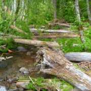
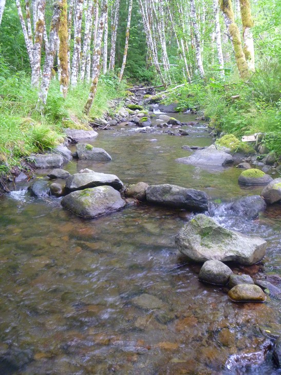
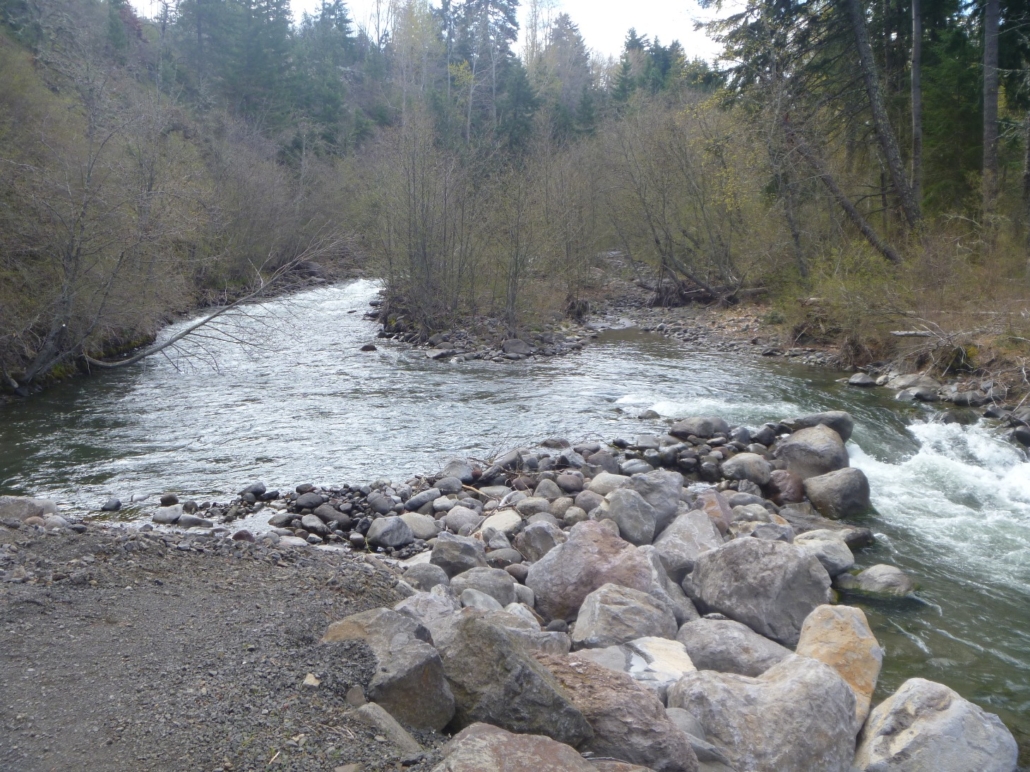
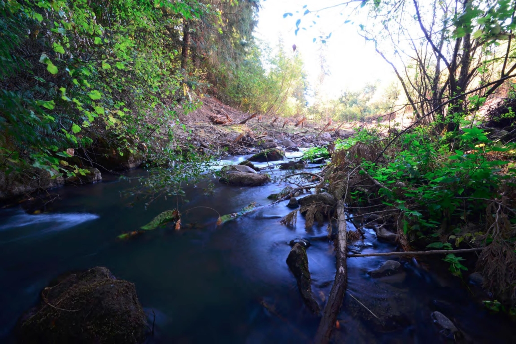
The West Fork at Jones Creek project took place on 0.6-mile reach of the upper West Fork Hood River between the confluences with Jones Creek and Ladd Creek. The project is located on
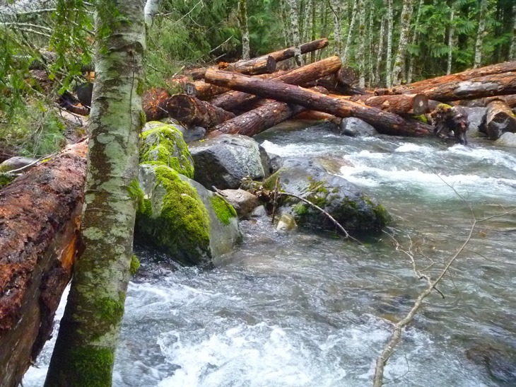
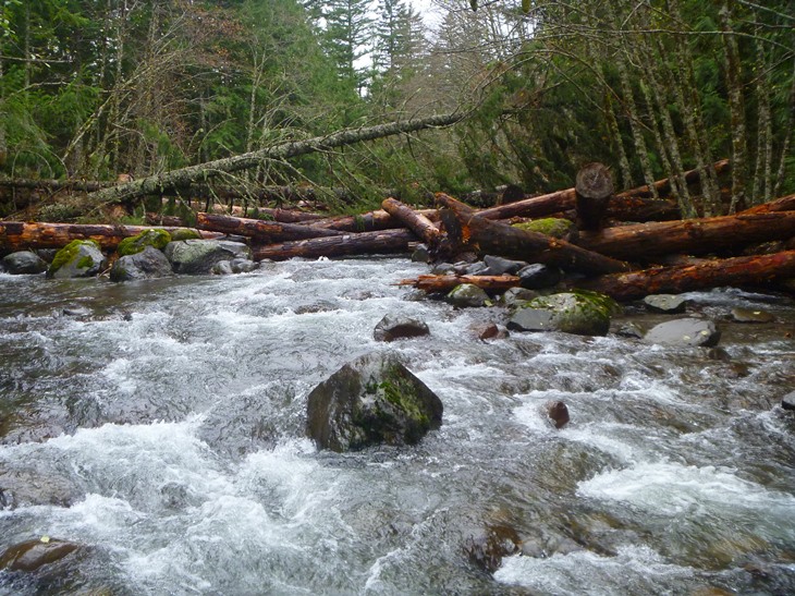
United States Forest Service (USFS) land on the Mt. Hood National Forest. The Upper West Fork provides some of the best spring Chinook, coho, and summer steelhead habitat in the Hood River Watershed because of its abundant, clear, and cold water in the summer. However, past timber management practices, like splash damming and removal of large riparian conifers, have led to insufficient amounts of large instream wood and loss of connectivity between the main channel and historic side channels. These factors have decreased the amount and quality of salmon and steelhead habitat.

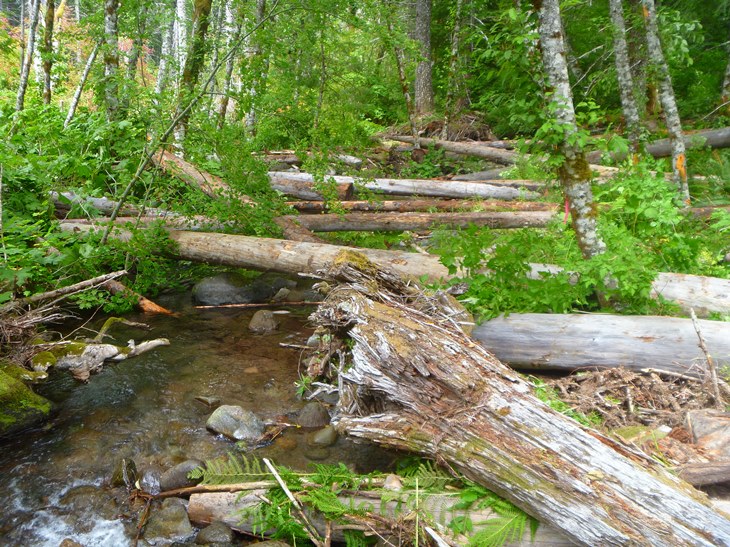
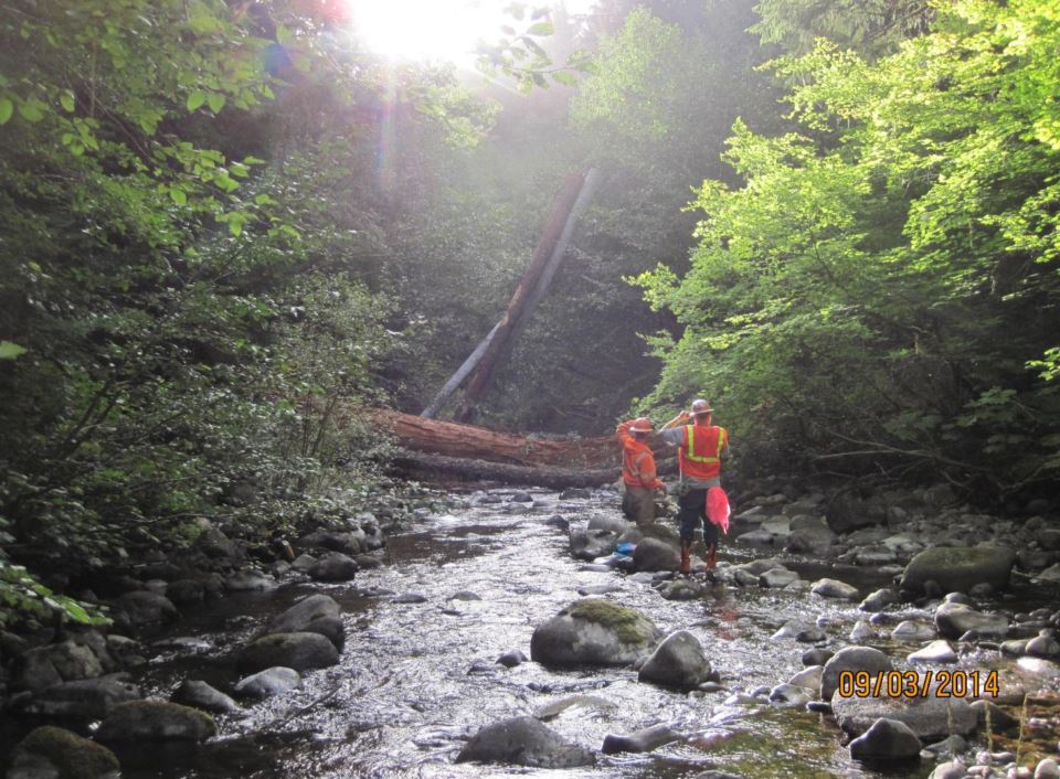
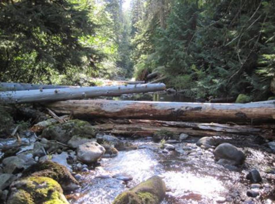
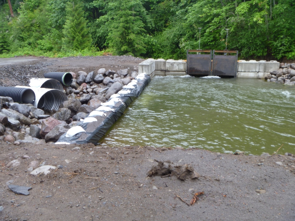
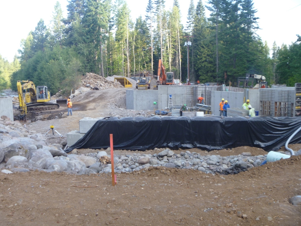
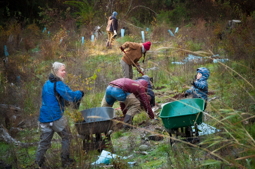
The U.S. Forest Service and Confederated Tribes of the Warm Springs have been actively restoring fish habitat on the Upper West Fork for several years. In 2016 and 2017, almost 1,000 pieces of large wood were placed in its channel and floodplain, and rock berms that had been created in the early 1900s were notched to allow the river to access its floodplain once again. More recently the Watershed Group has joined the team to assist with fundraising and project implementation. The long-term objectives of these projects are to improve spawning and rearing habitat by trapping and sorting spawning gravels, reconnecting side channels, creating new pools, increasing cover, and improving stream food web dynamics.

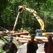
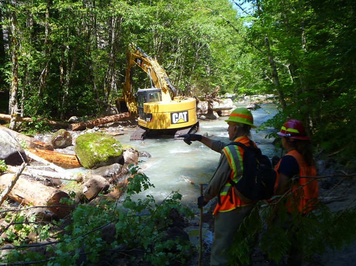
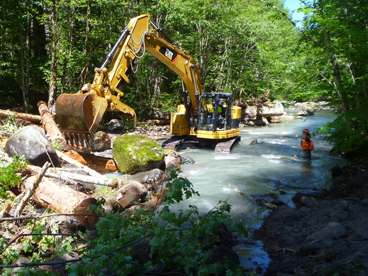
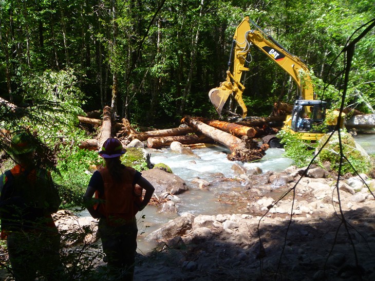
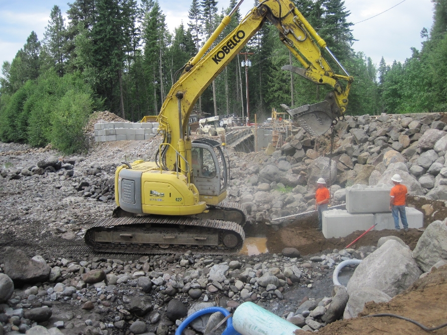
The goals of the West Fork at Jones Creek project were to improve and expand salmonid spawning and rearing habitat within the treatment reach. This was accomplished by placing approximately 380 pieces of large wood in 10-15 structures. Large wood structures will improve spawning habitat by trapping and sorting spawning gravels. They will improve rearing habitat by maintaining or reconnecting side channels, creating new pools, partitioning flow, increasing cover, and improving stream food web dynamics.

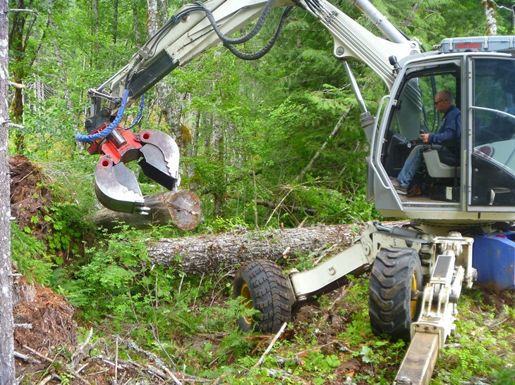
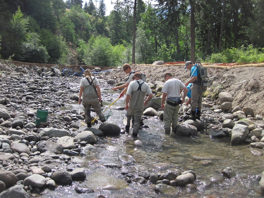
The project was managed by USFS staff. USFS provided the large wood and paid for its delivery to the site, and performed a modeling analysis of the design. Confederated Tribes of the Warm Springs developed the design for this project and assisted with implementation oversight. The Watershed Group staff assisted with contract administration, and is conducting pre- and post-project monitoring.

Redhill Creek after log placement.

Red Hill Creek Large Wood Placement Project

The US Forest Service (USFS) and the Confederated Tribes of the Warm Springs Reservation (CTWS) completed the Red Hill Creek Large Wood Placement Project in July 2016. This project was designed to restore spawning and rearing habitat for Chinook, steelhead, and coho in the lower 0.6 miles of Red Hill Creek, a tributary to the upper West Fork Hood River. About 220 logs were placed in 13 channel-spanning log structures and within the floodplain.

Funding was provided by CTWS, Bonneville Power Administration, and USFS. The project was completed on Weyerhauser property.

West Fork at Red Hill Habitat Enhancement Project

The US Forest Service (USFS) and the Confederated Tribes of the Warms Springs Reservation (CTWS) completed Phase I of the West Fork Hood River at Red Hill Creek Instream Habitat Enhancement Project in summer 2016. This project improved instream habitat for Chinook, steelhead, and coho in the West Fork Hood River from the confluence with Red Hill Creek to about 0.8 miles downstream.

Phase I focused on the upper 0.4 miles of the project reach. 430 logs were placed in 21 structures and within the floodplain, 42 trees were tipped onto the log structures, and 7 side channels were opened through berm removal.

Funding for this project was provided by CTWS, USFS, and the Whole Watershed Restoration Initiative. Other partners included: the landowner Weyerhauser, the Hood River SWCD, Oregon Dept. of Fish and Wildlife, and Oregon Dept. of Forestry.


Whiskey Creek Riparian Enhancement Project

In 2013, ODOT contracted with the HRWG to enhance 0.4 acres of riparian wetland to mitigate for wetland impacts from construction of the Historic Columbia River Highway State Trail. The mitigation project is located adjacent to Whiskey Creek and the Hood River on property owned by Columbia Land Trust. Restoration work required the eradication of reed canarygrass and blackberry and establishment of 800 native trees and shrubs. After three years of herbicide applications, planting, and mulching, the native plants were well on their way to improving habitat for native pollinators, birds, and wildlife.

As of 2020, the Watershed Group is partnering with Columbia Land Trust for additional restoration work at the Whiskey Creek site, expanding weed management and native tree and shrub planting to additional acreage within the property. 

Odell Creek Dam Removal and Stream Restoration

In summer of 2016, the Watershed Group, in partnership with Larry and Linda Hilton and the Oregon Department of Fish & Wildlife, removed the Odell Dam, restoring year-round fish passage to approximately five miles of winter steelhead habitat in Odell Creek. Unlike the Powerdale and Condit Dam removals, this project required restoration of the stream channel after the dam was removed. This included diverting the stream through a bypass pipe during the 3-month construction period and removing over 2,500 cubic yards (~210 dump truck loads) of sediment that had accumulated behind the dam.

Once the new channel area was excavated, large boulders and cobbles were placed to create the backbone of the new channel, and smaller cobbles, gravel, and sand were placed on top to form a natural streambed. Large wood was placed along the edge of the channel to improve fish habitat and protect 750 newly planted trees and shrubs from high streamflows. Lastly, a concrete vault with a fish screen was installed at the edge of the channel to replace the former irrigation diversion provided by the dam.

The Odell Creek Dam was built by Fred and Wilma Plog near the mouth of Odell Creek in 1985. It was operated as a private hydroelectric power-generating facility until 2010, at which time the Oregon Water Resources Department permit expired. To renew the permit, the dam needed to meet current fish passage and screening standards. However, an economic evaluation determined that upgrading the fish ladder and screen would cost more than future net power revenues would generate. Given the project’s negative value and the significant environmental impact to the creek, the landowner and hydro plant license holder agreed in 2013 to pursue decommissioning of the dam and restoration of the creek. Funding for this $450,000 project was provided by the Oregon Watershed Enhancement Board, the Oregon Department of Fish & Wildlife, and the Confederated Tribes of the Warm Springs.

Odell Creek is a non-glacial tributary of the lower Hood River, which has the potential to support winter steelhead, as well as populations of resident rainbow trout and coastal cutthroat trout within the 11 square mile watershed. To track the success of the dam removal and creek restoration, the Watershed Group has been conducting project effectiveness monitoring since the project was completed in 2016. This includes annual photo point monitoring for a visual representation of change over time, and monitoring of stream morphology characteristics over time. The Watershed Group also assists the Confederated Tribes of Warm Springs with annual fish surveys to track fish presence in the stream post-dam removal. As of 2019, the channel is performing very well and supporting a healthy population of fish. The riparian plantings are also doing well. The willow and Dogwood stakes along the channel margin have more than tripled in size. In the fall of 2019, the Watershed Group and a group of volunteers replanted an area on the west bank of the project where some plantings had suffered due to soil conditions.

Check out the dam removal and stream restoration process here.

Lake Branch Stream Restoration Project

Project_Lake Branch installProject_Lake Branch helicopterThe US Forest Service (USFS) and Confederated Tribes of the Warm Springs Reservation (CTWS) conducted a project in 2014 to help restore habitat for summer steelhead in Lake Branch. 603 logs were placed by helicopter along 1.7 miles of creek. The installation of large wood help restore and/or increase floodplain connectivity, increase stream habitat complexity, and collect and sort spawning gravels.

Project_Lake Branch result

Construction of the fish ladder

EFID Diversion Upgrade

The East Fork Irrigation District (EFID) Fish Passage and Diversion Upgrade was implemented in the summer of 2013 to improve EFID diversion operations and ensure fish passage up the East Fork Hood River.

Since the February 1996 flood swept down the Hood River Valley, EFID has been challenged with maintaining and operating their push-up dam and irrigation diversion above Tollbridge Park. The near-record flows changed the upstream channel configuration, making the channel less passable for steelhead and salmon populations.

This upgrade involved the installation of a pneumatically-operated Obermeyer weir, to replace the existing rock push-up dam, and a new diversion structure. The weir lies flat against the channel bottom during the off season to allow for natural river flows. During irrigation season, the weir plate is remotely raised and lowered by inflatable rubber bladders, allowing the diverted amount to be adjusted based on water demand. The upgrade also included a fish ladder to provide passage around the diversion when it is raised. EFID agreed to pass at least 15 cfs down the bypass reach for the 5 years following the project. During that time, flow was evaluated and future operating processes defined.

Construction of the project was done by Crestline Construction. The company began preparing the site in early June 2013. In-water work, including installation of the Obermeyer weir, connecting the fish ladder to the river, and removal of the existing rock weir, and final construction was completed in the fall of 2013. Erosion control measures were put into place for the winter. The construction site was revegetated in spring of 2014.

Funding and assistance was provided by the Confederated Tribes of Warm Springs (CTWS), Oregon Watershed Enhancement Board (OWEB), EFID, Title II, and the Watershed Group.

Powerdale Dam Removal

Projects_DamBeforeWork began in mid-April of 2010 on the long-awaited decommissioning and removal of Powerdale Dam. The dam has been removed along with the fish facility, intake structure, power canal, steel flume, and sand settling basin at the project’s upstream location.

The Hood River Watershed Group and other project partners documented the removal of the dam.

For more information and photos of the process, click here.