Powerdale Dam
Powerdale Post-Removal
In March 2013, the 400 acres of property around the former Powerdale Dam and facilities transferred from PacifiCorp to Columbia Land Trust and Hood River County ownership. Columbia Land Trust and Hood River County will manage the property to accomplish the four goals identified in the 2003 Settlement Agreement (protect and enhance fish and wildlife habitat, maintain recreational uses, expand recreation and education opportunities, and preserve tribal fishing rights). Learn more about the land and management plans from Columbia Land Trust.
Powerdale Dam Removal

In 2010, Powerdale Dam was decommissioned and removed. Work included removing the dam, fish facility, and other structures and lasted from April through October. Learn more about the PacifiCorp decommissioning process here. The Hood River Watershed Group and other project partners documented the removal in the photos below.
The HRWG owes special thanks to Phil Tennis of PacifiCorp and Joe May of Farmers Irrigation District for their help in photographically documenting the Powerdale removal process.
[slideshow size=”large” captions=”on” ids=”724,635,634,717,637,638,720,722,701,700,685,630,688,684,686,706,690,702,730,703,726,727,729,725,692,693,694,695,696,698,714,710,713,687,716,708,709,683,715,707,780,782,781″]
- PacifiCorp staff and invited public during an April 29th tour of the decommissioning project. (photo by Stampfli, HRWG)
- View of the ODFW / CTWS Powerdale Fish Facility taken during the April 29th tour. This facility will continue to be operated by ODFW until full-scale dam decommissioning begins on July 1, 2010. (photo by Stampfli, HRWG)
- Work accomplished in April involving deconstruction of the concrete flume which previously carried water from the dam to the “sand trap”. During earlier operation, the trap prevented sediment from entering into the pipeline leading to the powerhouse. (photo by Stampfli, HRWG)
- Removed portion of the steel flume. This material is being salvaged for use in building segments of a temporary coffer dams that will be used to reroute water from the dam deconstruction site in late summer. (photo by Tennis, PacifiCorp)
- Photo of 85 year old Powerdale surge tank being demolished for steel recycling. Two large cranes are used: one to support sections of the tower being freed using a cutting torch, and another for suspending a cage to position the welder employed by Weekly Brothers Inc. (photo by Hansen, PacifiCorp)
- View of continued progress on the deconstuction of the surge tank.
- The final pieces of the surge tank are hauled away in the early part of May.
- Construction of the bypass channel from the existing power canal to the river. Currently the bypass channel stops above the highwater mark. (photo by Phil Tennis, PacifiCorp)
- Close up of the excavator constructing the bypass channel from the existing power canal to the river. (photo by Phil Tennis, PacifiCorp)
- View of newly constructed river bypass channel on the East bank. This is where the majority of the Hood River’s flow will be diverted to allow deconstruction of the dam in a dry environment. (Photo by Steve Stampfli)
- West bank view of Powerdale dam on the first day of in-water work. Work on dam demolition will begin in early August, and end in the middle of September 2010. (Photo by Steve Stampfli)
- July 7, 2010 – Construction of downstream coffer dam, extending from West bank. As of today, this structure spans about 70% of the river channel. (Photo by Steve Stampfli).
- July 7, 2010 – Construction of downstream coffer dam, extending from West bank. As of today, this structure spans about 70% of the river channel. (Photo by Steve Stampfli).
- July 7, 2010 – View from the west bank of the river looking down the lower section of the bypass channel. Water will be routed around the dam during deconstruction using this channel and the fish bypass on the east bank. (Photo by Steve Stampfli).
- This photo shows the interior of the shelter atop Powerdale Dam, just prior to removal. Two of these winches are used to automatically control the reservoir level during operation, by moving the two large rolling gates. (Photo by Steve Stampfli).
- July 9, 2010 – The construction of the coffer dam continues. This structure will direct the river into the bypass channel around the dam while it is removed. (Photo by Eric Hansen)
- July 16, 2010 – The double pipes that run through the coffer dam (top of photo) represent the end of the planned bypass. The foreground shows installation of 9 foot diameter pipes being used to connect the base of the fish ladder to the double pipes below. (Photo by Steve Stampfli)
- July 23, 2010 – A Weekly Brothers excavator places the first section of the upstream coffer dam over the entrance to the fish bypass pipes. This temporary dam will prevent water from entering the work site during dam removal, starting August 1st. (Photo by Steve Stampfli).
- July 23, 2010 – The large pipe on the left is part of the downstream fish passage system, which allows fish to safely pass around the project during construction. The temporary fish ladder in the center allows adult fish to swim upstream past the construction. (Photo by Phil Tennis)
- July 30, 2010 – Downstream view of upper coffer dam construction, about 80% done. Actual dam removal will begin in the first week of August. Note removal of ODFW fish trap building from the east shore. (Photo by Steve Stampfli).
- July 30, 2010 – East view of upper coffer dam construction. Note upper end of fish bypass near top of scene. (Photo by Steve Stampfli).
- July 30, 2010 – Upstream view of upper coffer dam construction from top of dam (west side). A steel box segment is shown being fitted for later bolting. It will then be filled with rock, to help exclude water from the dam deconstruction site. (Photo by Steve Stampfli).
- August 5, 2010 – Tour of the Powerdale powerhouse conducted on Thursday, August 5th, showing Todd Olson (PacifiCorp Program Manager) standing atop the turbine housing, and explaining how the turbine / generator unit was recently removed. (Photo by Steve Stampfli)
- August 5, 2010 – Weekly Brothers excavators begin to remove sediment from below the dam. Once the dam is removed, the original channel grade will be restored and the shoreline will be stabilized and revegetated. (Photo by Steve Stampfli).
- August 13, 2010 – Two hydraulic excavators with jack hammer “rock buster” attachments, being used to demolish re-enforced concrete along Powerdale Dam spillway apron (Photo by Steve Stampfli).
- August 20, 2010 – Continued dam removal, beginning removal of large roller gates atop dam, and hauling in river rock to reform the new river channel. As the off-highway trucks haul in river rock for the new channel, they are able to haul out the concrete rubble from dam demolition site. (Photo by Steve Stampfli).
- August 25, 2010 – Image showing demolition of concrete roller gate towers. The roller gates and central portion of Powerdale dam are removed. The upstream coffer dam is clearly visible between the towers. Note blue roller gate winches still atop tower on right. (Photo by Steve Stampfli)
- August 31, 2010 – View looking upstream at lower face of the upper coffer dam. The two roller gate towers and major sections of dam have been demolished. A portion of one of the removed roller gates is visible on lower left. (Photo by Steve Stampfli)
- Sept 8, 2010 – View from west shore looking upstream where the dam used to stand. Note recently placed and graded river rock (the start of new river channel restructuring). The final channel will be this side of the large pipe in the background. (Photo by Steve Stampfli)
- Sept 9, 2010 – Around 2pm the first trickle entered the newly constructed channel and soon the whole river was flowing through it as the removal of the upper coffer dam began. With fish passage open, Weekly Brothers will remove the fish screen, ladder and water intake. (Photo by Steve Stampfli).
- Sept 10, 2010 – Photo from the east bank near downstream coffer dam. As the upper dam is removed, the river will flow into the deepest part of the new channel seen on the left. Remaining work will involve building the lower channel to establish a constant and stable river grade. (Photo by Phil Tennis).
- Sept. 16, 2010: A tour was provided to a German public television crew visiting the area to film a documentary. Pictured are ARD’s American correspondent Udo Lielischkies (left), producer Audrey Stimson (right), with PacifiCorp inspector Phil Tennis (middle). (Photo by S. Stampfli)
- Sept. 16, 2010: Reconstruction of the river channel and bank continue. Clean material is being used and construction debris has been removed. The entire project site is still closed to any river recreation or otherwise access. (Photo by S. Stampfli)
- Sept. 16, 2010: This photo shows the newly emerged shoreline of the reach just upstream of the former Powerdale dam site. Note the relative absence of fine sediment in the channel and shoreline, and the mouth of Neal Creek on the far right. (Photo S. Stampfli)
- Sept. 23, 2010: The lower coffer dam is breached and for the first time in 87 years, the Hood River flowed unencumbered of artificial structures in this reach. Kevin and Jared of Weekly Brothers carefully worked from both banks to remove the fill and pipe sections. (Photo by S. Stampfli)
- Sept. 23, 2010: Scene showing removal of second pipe through lower coffer dam, with Phil Tennis (PacifiCorp) and Paul DeVries (R2 Resource Consultants) observing. (Photo by S. Stampfli)
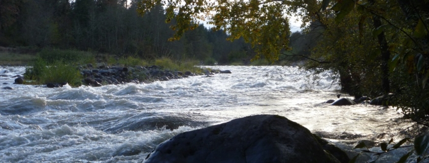
- Oct. 12, 2010: View from the westbank of the river after final regrading. Clean river rock was placed along the new channel to a level 8 feet above the ordinary high water mark. Powerdale Dam was at the top of the rapids seen in this photo. (Photo by S. Stampfli).
- Oct. 12, 2010: Wintun Seeding and Mulching of Roseburg began revegetation along the east bank of the dam site today. About 4,000 trees and shrubs will be planted on site. After planting, all disturbed soils will be hydromulched. (Photo by S. Stampfli).
- Oct. 15, 2010: The west shoreline a was hydromulched today. Hydromulching is a process of “painting” the land with a mixture of water, wood pulp and plant seeds. The applicator was careful not to hydromulch the seedlingsto minimizes grass and forb competition. (Photo by S. Stampfli).
- July 7, 2010. All three photos were taken from a permanent “photodoc” stand on the East bank. This view shows initial phases of decommissioning, with dam still in place.
- October 14, 2010. At this time, the dam has just been removed, revegetation done, and the channel reconstructed. Note comparatively low position of the channel bottom.
- May 4, 2011. Recent photo showing the results of winter runoff and channel re-adjustment. Note accumulation of 10+ feet of new material and new island at right. The new channel is still providing good fish passage.


